

ArcGIS for Microsoft 365
Esri, Inc. · Operations & Productivity
Certification per Microsoft Marketplace.
Evidence tier Source Confirmed · 9 captures on record
What the publisher says
As described on Microsoft Marketplace.
Large volume discounts are available for all customers.
Bring Location Analytics to your M365 Subscription with ArcGIS
Show the rest of the publisher’s description (20 more lines)
Microsoft 365 provides the world's leading business productivity tools which have become the common toolset for everyday work. ArcGIS for Microsoft 365 adds a spatial advantage to these business productivity solutions. Complement your M365 subscription by integrating spatial workflows and location-based insights to everyday productivity tasks. Leverage interactive mapping, visualization, and analytics tools that will transform the way you solve business problems.
ArcGIS for Microsoft 365 lets you
- Centralize Microsoft Teams communication, streamline collaboration, and transform teamwork with maps and apps
- Map and analyze Power BI data spatially to enhance your Power BI reports
- Create maps with Excel data to visualize pivot tables and formulas on a map in Microsoft Office
- Search for documents based on location and map your SharePoint content.
- Automate data pipelines with ArcGIS to enhance your data or move data between systems
ArcGIS for Microsoft 365 includes business productivity apps from Esri:
ArcGIS for Office
Gain new perspectives by putting Microsoft Excel data in the context of location. Location analytics transforms graphs and charts into interactive maps then use Microsoft PowerPoint to share your maps securely.
ArcGIS for Teams
Bring maps, 3D scenes, and apps to your organization for enhanced collaboration and geographic context. Keep teams organized by managing ArcGIS content, maps, and apps in one central location.
ArcGIS for Power BI
Built-in spatial analysis tools, reporting capabilities, and a rich collection of global content helps uncover patterns in your business data. Bring geographic data into Microsoft Power BI and integrate it with tabular or other types of business data.
ArcGIS for SharePoint
SharePoint users can search and share data-driven maps in a familiar framework. Find important documents fast by tagging and searching on a map. Easily format maps to match company branding and style.
ArcGIS for Power Automate
When engineering your data, records can be automatically geocoded and enriched with demographic variables, as well as actions that support moving data between systems. This includes taking the result analysis layers in ArcGIS and loading them into Power BI.
FOR US DISTRIBUTION ONLY.
Contact Esri directly if you are a US government, non-profit, or other customer with special pricing considerations. Outside of the United States, please contact your local Esri office for availability and pricing information.
Preview
1 image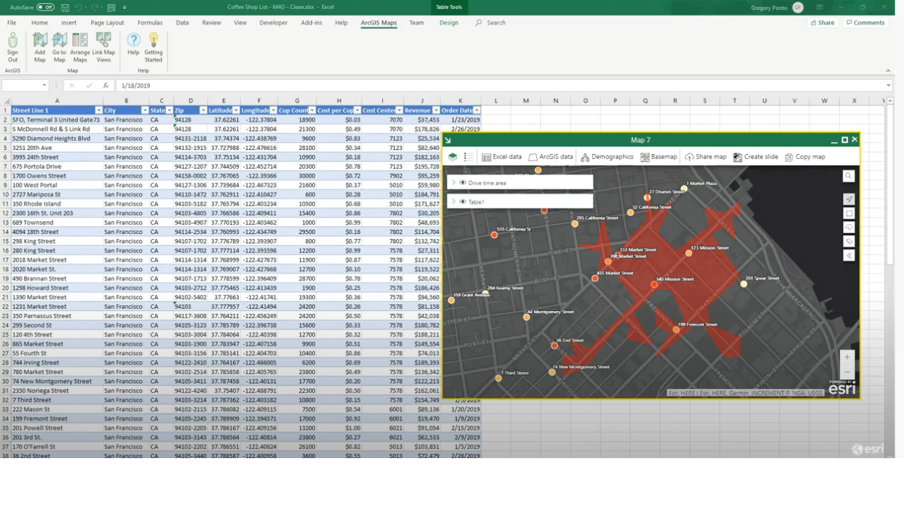
Agent build and provenance
See the full provenance
The layer-by-layer build, the evidence behind each claim, the risk basis and the cross-marketplace links are open to any account. Some rows are disclosed, some the source leaves Unknown; a free account shows you which.
Compliance
- FedRAMP AuthorizedConfirmed95%, domain-verifiedEsri Managed Cloud Services Advanced Plus is FedRAMP Authorized at Moderate impact (domain match)FedRAMP Marketplaceregistry recordas observed 2026-08-27
Confirmed means matched to a public authoritative registry. Claimed means the vendor or its listing states it, not yet cross-checked. A framework not shown was not found in any source we hold, which is not evidence against it. Not listed means a scoped registry check found no match for this vendor's domain: a No is a scoped registry check, not a compliance judgment. Confidence bands: 95% domain-verified, 90% registry-checked, 80% self-attested, 70% weak signal. Self-attested items marked “vendor's site” are gathered from the vendor's own website and are not verified by us.
Vendor
External enrichment · as of 2026-07-15
Plans and pricing as listed
2 listedSources
Publisher resources
6 linksLinked repositories
Unknown means this listing does not publish a repository. It is not a statement that the code is closed, and a linked repository is not a claim that the publisher wrote it: the registry computes that relationship privately and does not publish it.
Evidence risk is the share of the build you cannot see before you deploy, not a security rating. Sign in to see the layer-by-layer basis for this band.