

ArcGIS for Teams
Esri, Inc. · Intelligence & Research
Certification per Microsoft Marketplace.
Evidence tier Publisher Attested · 10 captures on record
What the publisher says
As described on Microsoft Marketplace.
Explore a trending world of maps and data
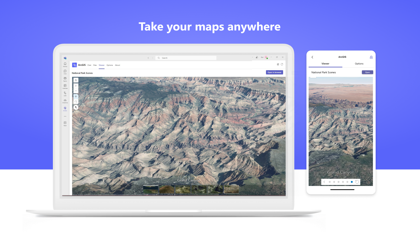
Maximize collaboration with powerful mapping and spatial analytics software. ArcGIS for Teams allows you to access ready-to-use datasets including demographics, psychographic and business data, live feeds like traffic and weather, places, movement data, and high-quality imagery in Microsoft Teams, Outlook, and Microsoft 365. Share the latest maps that are trending globally, or find hyper-local applications created by your local governments.
Show the rest of the publisher’s description (27 more lines)
Discover geospatial applications that use data visualization tools to see unique patterns and relationships. Using data-driven visualizations, you can create rich interactive 2D and 3D maps. Use ArcGIS for Teams with Microsoft 365 Copilot to seamlessly search for ArcGIS content. These tools work both client-side for highly interactive user experiences, and server-side to help you scale with large amounts of data.
Get Started with ArcGIS for Teams.
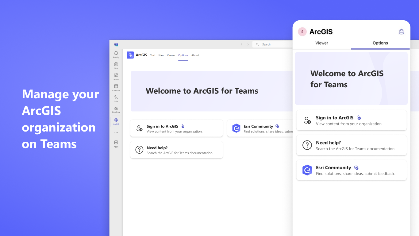
Log in to your ArcGIS account and gain access to private content across your organization in a centralized application, in addition to millions of public maps and applications.
Capabilities:
- Search Maps with Natural Language: Use conversational language to discover a maps, apps, and layers from ArcGIS within Teams chats and Copilot
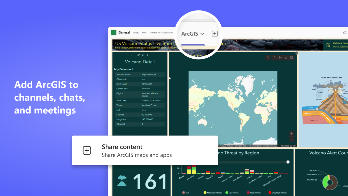
- Access Maps and Apps in Conversations: View and interact with maps, 3D scenes, and applications directly in Teams channels, chats, and meetings without switching applications
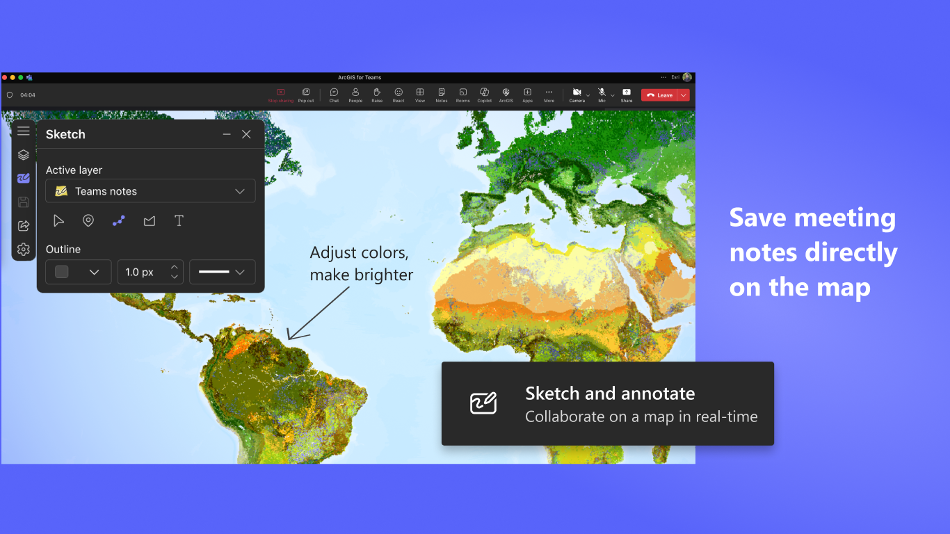
- Collaborate on Maps During Meetings: Present maps in real-time during Teams meetings, allowing all participants to explore, sketch, annotate, and discuss geographic content together
- Access Private and Public Content: Access both public ArcGIS Living Atlas content and your organization's private maps, layers, and applications
- Manage users directly in Microsoft Teams: Admins can add members, assign user types, and set roles in ArcGIS for Teams, streamlining onboarding without leaving Microsoft Teams.
Learn more about the latest updates in ArcGIS for Teams.
Permissions
This app will have permission to:
- Receive messages and data that I provide to it.
- Send me messages and notifications.
- Access my profile information such as my name, email address, company name, and preferred language.
- Receive messages and data that team members provide to it in a channel.
- Send messages and notifications in a channel.
- Access this team's information such as team name, channel list and roster (including team member's names and email addresses) - and use this to contact them.
Use Cases
- Emergency Response Coordination: Emergency management teams can share incident maps during Teams meetings, allowing all responders to view current situations, mark affected areas, and coordinate resources. Annotate evacuation of routes and damage assessments in real-time during active incidents.
- Field Operations Support: Operations centers can share maps and dashboards with field teams in Teams channels, providing situational awareness and coordination. Team members can quickly search for relevant maps using natural language and discuss operational changes with full geographic context.
- Urban Planning Reviews: Planning departments can share development proposals and zoning maps in Teams meetings with stakeholders. Participants can annotate areas of concern, suggest modifications, and discuss impacts collaboratively on a shared map view.
- Executive Location-Based Briefings: Leadership teams can review market performance, expansion opportunities, or operational metrics on maps during strategic meetings. Search for relevant maps using Copilot and make informed decisions based on geographic patterns and trends.
Supported Languages
Arabic, Bosnian, Bulgarian, Catalan, Croatian, Czech, Danish, Dutch, English, Estonian, Finnish, French, German, Greek, Hebrew, Hungarian, Indonesian, Italian, Japanese, Korean, Latvian, Lithuanian, Norwegian, Polish, Portuguese (Brazil), Portuguese (Portugal), Romanian, Russian, Serbian, Simplified Chinese, Slovak, Slovenian, Spanish, Swedish, Thai, Traditional Chinese (Taiwan), Traditional Chinese (Hong Kong), Turkish, Ukrainian, and Vietnamese.
About Esri
Esri is the global leader in geographic information system (GIS) technology, providing powerful mapping and location intelligence solutions that help organizations understand their world and drive better outcomes. Across industries, governments, and communities, Esri’s trusted geospatial platform transforms data into insight, enabling smarter decisions, improved operations, and meaningful impact. Learn more at esri.com.
Preview
5 images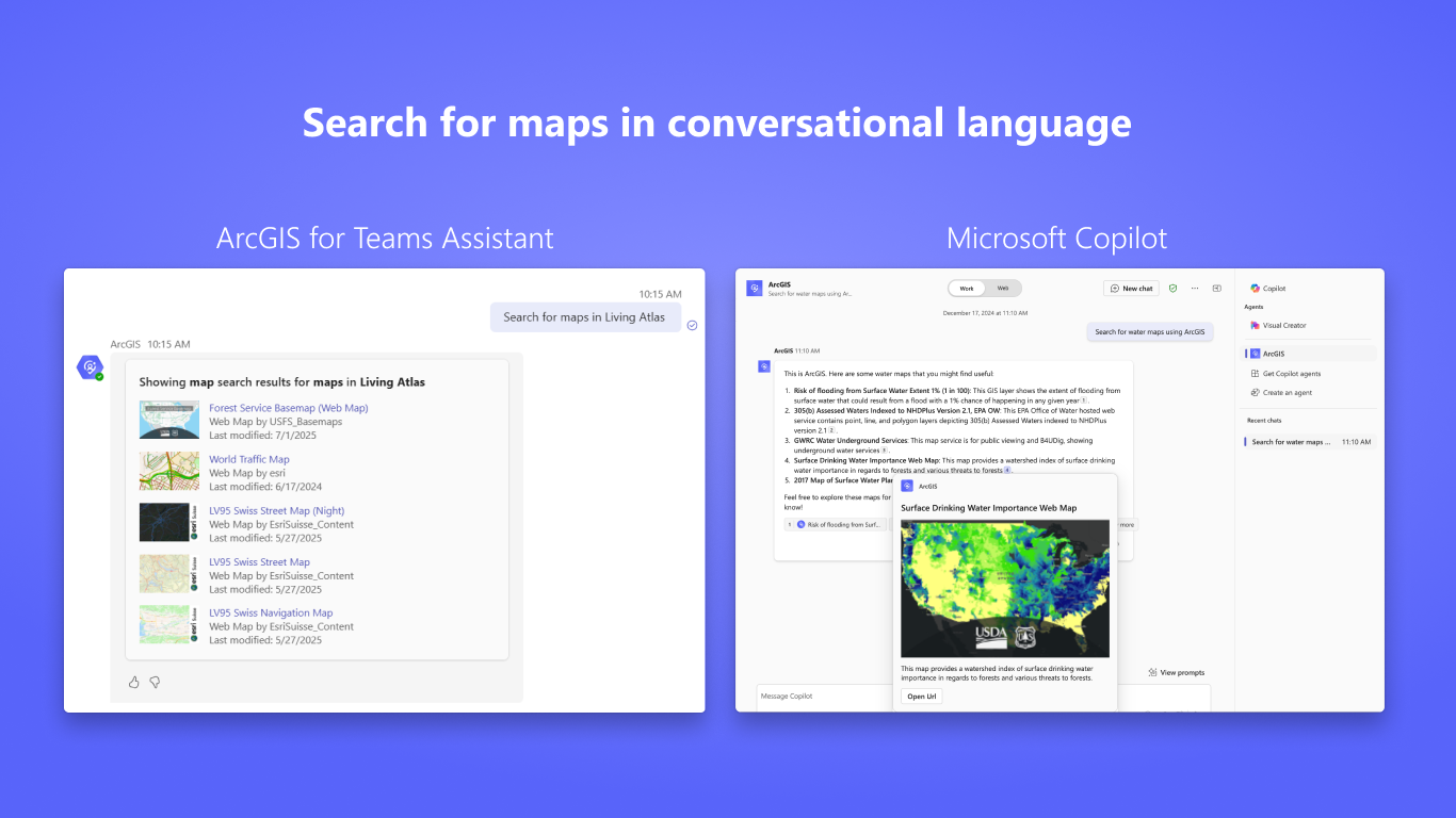
Agent build and provenance
See the full provenance
The layer-by-layer build, the evidence behind each claim, the risk basis and the cross-marketplace links are open to any account. Some rows are disclosed, some the source leaves Unknown; a free account shows you which.
Compliance
- FedRAMP AuthorizedConfirmed95%, domain-verifiedEsri Managed Cloud Services Advanced Plus is FedRAMP Authorized at Moderate impact (domain match)FedRAMP Marketplaceregistry recordas observed 2026-08-27
- NIST SP 800-171Claimed80%, self-attestedself-attested on the marketplaceas observed 2026-08-25
- CSA STARClaimed80%, self-attestedself-attested on the marketplaceas observed 2026-08-25
- GDPRClaimed80%, self-attestedself-attested on the marketplaceas observed 2026-08-15
Confirmed means matched to a public authoritative registry. Claimed means the vendor or its listing states it, not yet cross-checked. A framework not shown was not found in any source we hold, which is not evidence against it. Not listed means a scoped registry check found no match for this vendor's domain: a No is a scoped registry check, not a compliance judgment. Confidence bands: 95% domain-verified, 90% registry-checked, 80% self-attested, 70% weak signal. Self-attested items marked “vendor's site” are gathered from the vendor's own website and are not verified by us.
Vendor
External enrichment · as of 2026-07-15
Sources
Publisher resources
1 linkLinked repositories
Unknown means this listing does not publish a repository. It is not a statement that the code is closed, and a linked repository is not a claim that the publisher wrote it: the registry computes that relationship privately and does not publish it.
Evidence risk is the share of the build you cannot see before you deploy, not a security rating. Sign in to see the layer-by-layer basis for this band.